© city-map AG ‐ Map data © OpenStreetMap contributors


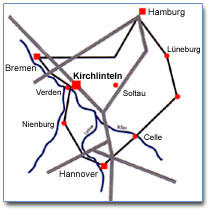
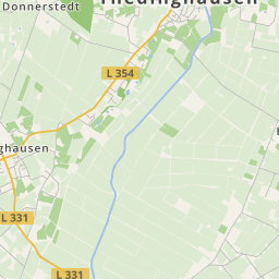
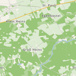
Kirchlinteln is conveniently situated in the rural district Verden at the fringe of the Lüneburger Heide, bordering onto the rural district of Rotenburg (Wümme) and Soltau-Fallingbostel.
The emblem of the community Kirchlinteln shows, looking onto the emblem, on the left on gold a blue plough, in the split emblem on red a continuous cut Latin high cross.
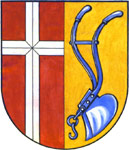
The meaning of the emblem symbols:
The cross -
depicted as an ecclesiastical cross - probably referring to the community's name Kirchlinteln (church) as well as to the predominantly religious basic attitude of the citizens of the former 17 communities in this eastern district area with its expansion of around 174 square kilometres. The 'continuous cut silver coloured' cross is to remember the 'Lüneburger Salzstraße', which runs from east to west with its junctions, over which merchants brought their valuable wares - mainly salt from the Lüneburg area - often under difficult and dangerous circumstances to the market. The white colour and the cut of the cross point to the salt crystal.
The plough -
depicted as a single-bladed hand plough - has been as such more or less completely replaced by tractor pulling multi-bladed plough. The plough's blue points to the Aller as this river forms in part the community border. As the plough has always been seen as the embodiment and symbol of farm work (stands in newer emblem design often as 'banal and too general' heraldic figure), it should be consciously perceived as the 'most original and basic working tool' of early and present farming symbol.