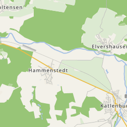


© city-map AG ‐ Map data © OpenStreetMap contributors


The village Avendshausen is situated directly at the northern district border and off any important main roads in the Ilme basin. The village can be reached only via the one road that runs from Vardeilsen to Rengershausen. This remote location also influenced the development of the village. The village originated and grew in fertile arable land, even though there was little room for agriculture due to the few natural spaces. The 260 ha large district stretches between five elevations, which surround the village on all sides.
